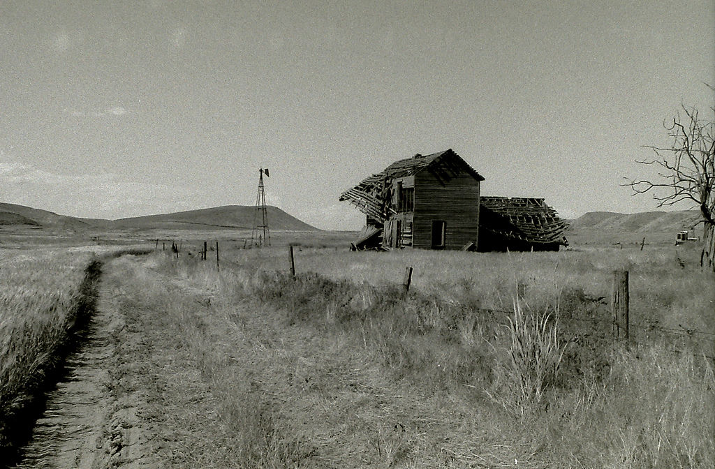
Old wagon ruts are all that's left of the Mullan Military Road, which was built in 1862 and served as an overland connection between Fort Benton, Montana, and Fort Walla Walla, Washington.
Traveling the Road That Time Forgot
The first federally built wagon trail in the West, ruts and all
By Andrew Tarica
The map was intriguing. It had no major roads and listed only a few scattered towns and western forts.
Indian nations and major rivers were clearly laid out, as was a solitary wagon road – the Mullan Military Road – that extended across the unexplored land north of the Oregon Trail.
Completed in 1862, the road stretched over the Continental Divide a total of 624 miles, and it served as an overland connection between Fort Walla Walla, Washington, on the Columbia River, and Fort Benton, Montana, on the Missouri River.
It was summer when I trod on dry sage and walked, map in hand, along this piece of nearly forgotten American history in eastern Washington. My traveling partner, Scott DeSimone, and I had just taken a four-wheel-drive path over a barren hill that led deep inside an ocean of rolling brown scablands.
At the crest of a hill, we saw an abandoned pioneer home that had been invaded by defiant, raucous crows. Off to the side of the eerie home, behind a rundown windmill, was the vintage Mullan Road.
“Our first confirmed sighting,” said Scott, who, like me, had been itching for an adventure.
We hiked along the road for awhile, taking note of the old wagon ruts and overgrown bushes that covered much of the path. It was hot and sunny, and the pungent smell of dirt enlivened the dry air.
We continued through a number of tiny towns where the Mullan Road passed during the frontier era – Benge, Lamont, Spangle.
Construction began on June 25, 1859, when a group of about 100 United States soldiers – under the command of their ambitious, 28-year-old captain, John Mullan – began blazing a trail east from Fort Walla Walla.
Armed with a dependable four-wheel-drive, maps and fly rods, rather than wagons, oxen and muskets, Scott and I retraced their route.
******
In desert country that stretched between Walla Walla and Lake Coeur d’Alene, we found several stretches of original Mullan Road.
The trail was mostly hidden behind the scrubby hills or off to the side of current main roads, behind barb-wired fences. Unmistakable wagon ruts stretched here and there into the distance, reinforcing our growing respect for the original trailblazers.
In some places we saw only fragments of the original road. For example, just north of Walla Walla, Highway 25 crosses the Touchet River near the town of Prescott. Underneath the new concrete bridge we found the half-buried, wooden remains of the bridge Mullan and his crew built.
It was the winter of 1853-54 when Mullan, who was then part of Isaac Stevens’ transcontinental railroad survey, first discovered a feasible wagon route over the Continental Divide in what is now Montana.
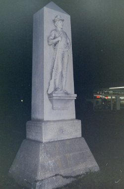
A statue of Captain John Mullan in St. Regis, Idaho.
At the small town of Avon, Montana, we turned onto a dirt road and headed toward Mullan Pass – original wagon ruts leading the way. The path rose gradually over the divide. At the top, big-sky views stretched into the vast valley drained by the Missouri River.
Though the Mullan Road never achieved the popularity of the Oregon Trail (it was too far north and spring floods often washed trees over its path), it was a travel route for thousands of settlers, gold miners and other fortune seekers.
Some emigrants used the road to settle the sparsely populated areas. Mostly, though, the Mullan Road was a supply route for the gold camps of Montana in the mid-1860s and the mines of Idaho’s Silver Valley in the 1880s.
It took roughly 55 days for the early settlers and prospectors to travel the entire length of the road. Scott and I leisurely took fiver.
******
Although one of the original missions for building the Mullan Road was to transport federal troops to the Pacific, it was used only once for this purpose.
In May of 1860, under the direction of Major George Blake, 300 new recruits left St. Louis by steamer on the Missouri, arriving at Fort Benton about two months later. At the urging of Mullan, who was eager to have his road tested before he proclaimed it finished, the troops then moved toward Walla Walla over his route.
August V. Kautz was a member of that expedition, and on July 12, he wrote in his diary about a fishing trip he took with two fellow soldiers and a member of the Blackfeet tribe at a place called Highwood Creek, about four hours from Fort Benton by wagon.
“We immediately commenced fishing,” Kautz wrote. “And in two hours I had captured 18 small trout with flies. I think, however, that grasshoppers are better, as I found upon examination that is their principal food.” The next day, according to his journal, he caught 45 fish.
From Fort Benton and Fort Walla Walla, Kautz fished for catfish in the Missouri and for trout in the Dearborn River, Little Prickly Pear Creek, Rock Creek, Bitterroot and the North Fork of the Coeur d’Alene River.
Arriving at the North Fork more than 130 years later, Scott and I decided to fish, too. At a local restaurant called the Enaville Resort (formerly a brothel called The Snake Pit), we met Joe Peak, the self-proclaimed resident fisherman of the river. “The thing about fishing the Coeur d’Alene,” he said, shaking his head and smiling, “is that if it looks good, fish it.”
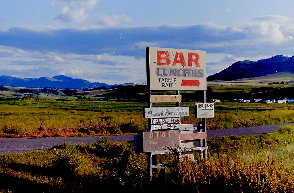
The Mullan Road passed through the Missouri River and some of the country's best fly-fishing for trout.
With that thought, we spied a fishy-looking hole just upstream from the tiny outlet of Yellow Dog Creek. The bank was extremely lush, and heavily forested mountains surrounded it on both sides. It was also packed full of Westslope Cutthroat trout, the only trout native to the Rocky Mountain area.
The flies we fished included Renegades, Grey Wulffs and a light-blue mayfly called a Couer d’Alene Special. At one point in the late afternoon, as the rain beat down, the fish became active.
Unhooking a pesky, 14-inch native trout, I marveled at its golden color and large, evenly spaced spots. Scott was nearby. “Man, they are just so beautiful,” he said. “Even if I wanted to kill them, I don’t think I could.”
It recalled something I had read in the Monday Oregonian, from Portland, dated August 28, 1862, which was written by the first party of emigrants that traveled the Mullan Road. In describing their voyage, they wrote, “The streams are filled with trout, weighing 1 to 6 pounds, which have afforded us rare pleasure in their capture.”
******
Our fifth and final day on the Mullan Road began in Great Falls, Montana. On Highway 87, we headed northeast toward Fort Benton. The views along this section were expansive. Countless layers of clouds and distant mountain ranges shared the giant sky of Montana. After traveling more than 800 miles through the back roads of Washington, Idaho and Montana, we were finally on the home stretch.
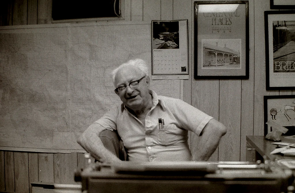
Joel Overholser, former editor of the The River Press in Fort Benton Montana.
As we pulled into Fort Benton, the so-called birthplace of Montana, traces of the community’s rich past – which included a visit by explorers Lewis & Clark during their 1805 expedition to the Pacific – could be seen all over town.
A hotel built in 1882, which used to boast the finest accommodation between Minneapolis and Seattle, stood vacant along Front Street. Behind the dilapidated building, the oldest bridge in the state spanned the mighty Missouri. At the far end of town, ruins of the old fort reflected the first permanent white settlement in Montana.
Nearby a statue of Captain Mullan explained that his road was the first federally built highway in the West. In the offices of the Museum of the Great Plains, we met Joel Overholser, who recently retired after serving as editor of the local paper, The River Press, for nearly four decades.
In one of his editorials, Overholser wrote, “The Mullan Road faded into historical oblivion, and indeed its somewhat visionary purpose was largely nullified with the opening of the first transcontinental railway in 1869. Yet hundreds of its 624 miles are today retraced by modern highways and railroads, so the route can be credited a pioneer forerunner, and one of the great historic trails of America … a few traces and ruts even remain here and there.”
And a lot of potential adventures lie in between.